Ground Penetrating Radar
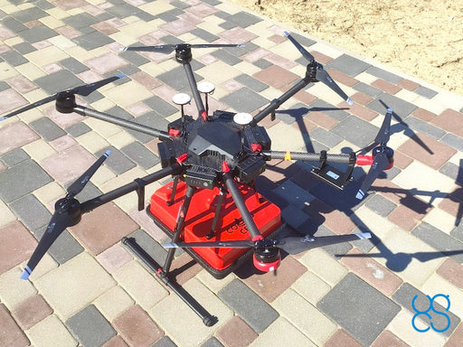
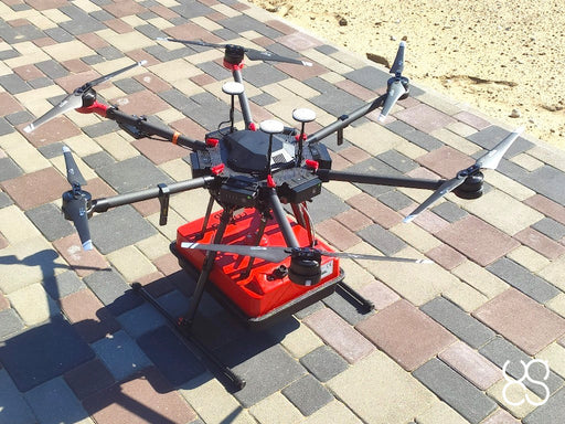
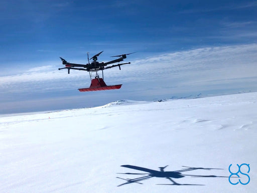
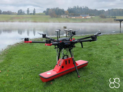
Detailed subsurface data with specialized drone-mounted GPR systems. There are several standard methods for conducting GPR surveys, each with its benefits and drawbacks. No single method is universally applicable; the appropriate or most suitable approach should be chosen based on the survey target and environmental conditions.
Discover the airborne GPR technology by SPH Engineering explained »»»
-
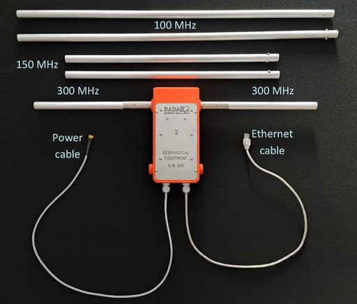
GPR system: Radar Systems Zond Aero LF (low frequency)
Radar SystemsExtra-lightweight GPR system, suitable for medium-sized drones like DJI M400/M300/M350 RTK. Zond Aero LF is extremely customizable GPR system in te...
View full details -
GPR system: Radar Systems Zond Aero 600 "NG"
Radar SystemsUniversal ground penetrating radar system for terrestrial and airborne surveys with real-time sampling (RTS) technology and advanced built-in digit...
View full details -
GPR system: Radar Systems Zond Aero 500 "NG"
Radar SystemsUniversal ground penetrating radar system for terrestrial and airborne surveys with real-time sampling (RTS) technology and advanced built-in digit...
View full details -
GPR system: Radar Systems Zond Aero 1000 "NG"
Radar SystemsUniversal ground penetrating radar system for terrestrial and airborne surveys with real-time sampling (RTS) technology and advanced built-in digit...
View full details -
GPR system: MALÅ GeoDrone 600
MALÅThe MALÅ GeoDrone 600 is an airborne GPR system designed especially for the drones. The MALÅ GeoDrone utilizes the latest GPR HDR technology from G...
View full details -
GPR system: Radarteam Cobra Drone CBD GPR
RadarteamAirborne version of the Radarteam Cobra CBD GPR system.
-
GPR system: Radarteam Cobra Plug-In GPR
RadarteamLow-frequency GPR system with 3 antenna options: SE-40: 52MHz SE-70: 80MHz SE-150: 124MHz
Information
Our drone-mounted GPR systems have been field-tested in some of the world's most challenging environments, from the icy terrains of Greenland and Iceland to the diverse landscapes of Papua New Guinea, Israel, and throughout Europe. This extensive field experience ensures our systems deliver reliable performance and accurate data in any condition.
Each GPR system features real-time sampling technology and advanced digitizers that capture high-resolution subsurface data, allowing you to detect and map underground features with centimeter-level precision. Whether you're mapping archaeological sites, assessing infrastructure integrity, or conducting geological surveys, our aerial GPR solutions provide the detailed insights you need to make informed decisions.
Frequently Asked Questions
What advantages do drone-mounted GPR systems have over traditional ground-based GPR?
Drone-mounted GPR systems offer access to difficult or dangerous terrain, centimeter-level accuracy, and repeatability, which is crucial for long-term research and studies. In addition, SPH Engineering offers interoperability for different payloads using the same UAV with the SkyHub onboard computer.
What depth can SPH Engineering's GPR systems penetrate?
Penetration depth varies based on soil conditions and the specific GPR system used. Our systems typically achieve depths of 0.3 till 10 meters in average conditions, with greater penetration in dry, sandy soils and less in wet, clay-rich environments. Each system is optimized for specific depth ranges and applications.
Can these GPR systems be integrated with existing drone fleets?
Yes, our GPR systems are designed for compatibility with industry-standard drones like the DJI M300/M350/M400 and US manufacturers, e.g. Inspired Flight or Harris Aerial. Integration kits and mounting solutions are available to ensure proper balance and secure attachment. Our technical team provides support throughout the integration process to ensure optimal performance.
What software is used to process and analyze the GPR data?
Our systems are compatible with industry-standard GPR processing software. Additionally, we offer specialized software solutions (GeoHammer) that streamline the workflow from data collection to visualization, allowing for efficient analysis and interpretation of subsurface features.
What training is required to operate these aerial GPR systems effectively?
We provide comprehensive training programs covering system operation, flight planning, data collection protocols, and basic data interpretation. Most surveyors with drone piloting experience can become proficient with our GPR systems after completing our training program.