Integrated Systems
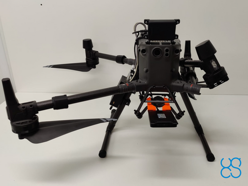
Expand your drone capabilities with SPH Engineering's professional integrated systems; the most comprehensive solution for advanced sensor integration and data collection. Our SkyHub onboard computer serves as the central nervous system, enabling seamless integration of diverse sensors with professional UAV platforms while maintaining complete data security and operational reliability.
Designed for professionals in geophysical surveying, hydrographic operations, environmental monitoring, and archaeological research, our integrated systems combine industry-leading sensors with specialized UAV integration. From ground penetrating radar to magnetometers, methane detectors to echo sounders, each system is engineered for precision data collection in challenging environments where traditional methods fall short.
-
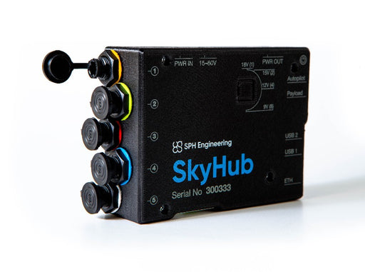
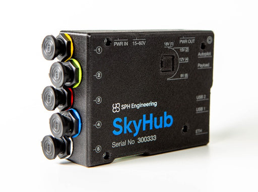
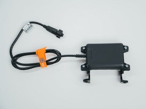
SkyHub on-board computer hardware
SPH EngineeringSkyHub is an onboard computer to log geotagged data from various sensors like GPR, altimeter, magnetometer, echo sounder, or methane detector. Disc...
View full details -

 Original price 724.00 USD - Original price 724.00 USDOriginal price724.00 USD724.00 USD - 724.00 USDCurrent price 724.00 USD
Radar altimeter for True Terrain Following
SPH EngineeringRadar altimeter for SkyHub onboard computer. The main benefit of radar altimeter: it works in ANY conditions like bright sun, fog, snow, rain, and...
View full detailsOriginal price 724.00 USD - Original price 724.00 USDOriginal price724.00 USD724.00 USD - 724.00 USDCurrent price 724.00 USD -

 Original price 913.00 USD - Original price 913.00 USDOriginal price913.00 USD913.00 USD - 913.00 USDCurrent price 913.00 USD
Laser altimeter for True Terrain Following
SPH EngineeringLaser altimeter for SkyHub onboard computer. Practical range: up to 100m; up to 10m high-reflective surfaces like water, ice, snow, and sand (unde...
View full detailsOriginal price 913.00 USD - Original price 913.00 USDOriginal price913.00 USD913.00 USD - 913.00 USDCurrent price 913.00 USD -
 Original price 593.00 USD - Original price 593.00 USDOriginal price593.00 USD593.00 USD - 593.00 USDCurrent price 593.00 USD
Obstacle detection radar for DJI M300/M350 RTK drones
SPH EngineeringObstacle detection system for DJI M350/M300 RTK drone, includes sensor and mounts. Detects obstacles in front of the drone at far distances, range ...
View full detailsOriginal price 593.00 USD - Original price 593.00 USDOriginal price593.00 USD593.00 USD - 593.00 USDCurrent price 593.00 USD -
 Original price 4,387.00 USD - Original price 4,387.00 USDOriginal price4,387.00 USD4,387.00 USD - 4,387.00 USDCurrent price 4,387.00 USD
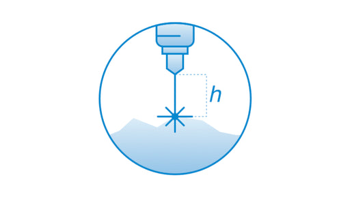
SkyHub software package for True Terrain Following
SPH EngineeringAllows following terrain with very high precision on low altitude using an altimeter sensor. Requires SkyHub on-board computer compatible altimet...
View full detailsOriginal price 4,387.00 USD - Original price 4,387.00 USDOriginal price4,387.00 USD4,387.00 USD - 4,387.00 USDCurrent price 4,387.00 USD -
 Original price 1,435.00 USD - Original price 1,435.00 USDOriginal price1,435.00 USD1,435.00 USD - 1,435.00 USDCurrent price 1,435.00 USD
Trainer-led course - UgCS Area Scan and True Terrain Following (TFF) Missions
SPH EngineeringTraining is recommended for users of UgCS software and Integrated Systems who already have basic knowledge of UgCS. Training can be provided at th...
View full detailsOriginal price 1,435.00 USD - Original price 1,435.00 USDOriginal price1,435.00 USD1,435.00 USD - 1,435.00 USDCurrent price 1,435.00 USD


